Where the heck is the water? Is Whiskey Creek a harbinger of climate catastrophe? Part 2
Where’s the flood?!
“Out of sight, out of mind” best explains the relationship that I have had with Arenas Valley years since 1957, when my family moved to Silver City and my paternal grandparents moved into the Arenas Valley house. I was 13 when we moved to Silver City, and 19 when I left to join the Navy.
When I was still living at home in Silver City, my family frequently visited my grandparents for holiday meals or family get-togethers, often watching the Ed Sullivan Show orGunsmoke. Even though my Arenas Valley friends and I attended the same high school, our paths to adulthood diverged, and we rarely hung out together. Never again did I go on a hike in Arenas Valley or even take a walk down Arenas Valley Road to revisit Whiskey Creek. Only in the summer of 2025 did I get around to taking a look at Arenas Valley by way of Google Maps’ impressive Street View app. I did not expect what I saw.
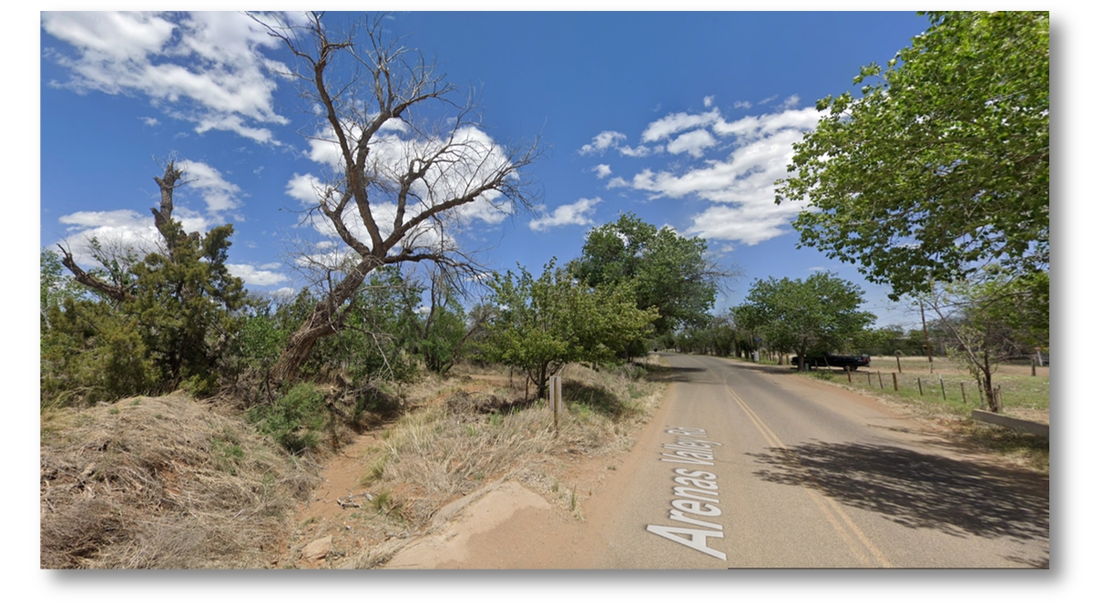
I started my “drive” on Arenas Valley Road where it intersects with U.S. Highway 180, about four miles east of Silver City. Along the way, about a virtual mile from our old house, I discovered another arroyo that I had never noticed, and no wonder: it was just a dry, weed-filled depression that must once have carried enough water to result in the construction of a culvert to carry it beneath Arenas Valley Road. I had never before noticed it despite being driven over it thousands of times in our family car or on our school bus. Google Maps doesn’t name it, but an on-line search soon turned up a surprising Spanish name — Rio de Arenas — which translates to Sand River or River of Sand. Rio de Arenas must be the source of the official name for Arenas Valley’s official name, bestowed on the community when its post office opened in 1946, but that doesn’t explain why Arenas Valley wasn’t named Whiskey Creek since the Whiskey Creek arroyo is so much closer!).
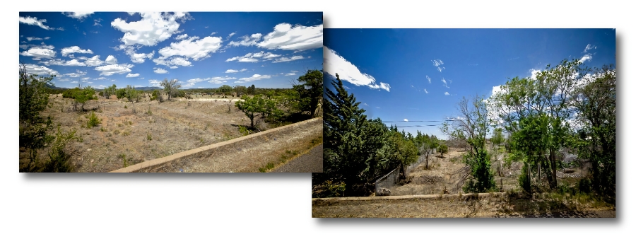
If I was surprised to “discover” the Rio de Arenas, I was astonished to see how Whiskey Creek had changed. Over the years, what used to be a broad “avenue” of sand had vanished, leaving behind a thin, sandy shadow of itself, mostly overgrown with weeds and brush. Large cottonwood trees that grew on the north bank of Whiskey Creek are still there, including one that my friends and I used to climb on a regular basis. I wouldn’t dare to climb it now, not that I could, because it’s a lifeless, leafless, brittle skeleton of a tree and must soon fall down to decay and join its old, lifeless roots. Neverless, looking at this image I can almost hear the voices of my friends and me coming from high in its branches.
There’s a mystery here. Why would Whiskey Creek devolve, in just 70 years, into a mere shadow of its former, formidable self? Why is the bed of the arroyo now a tiny fraction of its width in the 1950s? Why are shrubs growing on its banks where there were few if any in the 1950s? And why have raging flash floods stopped flooding Whiskey Creek? Never in my life have I encountered such a “sudden” change in local geography. Volcanoes can literally blow their tops and bury cities in ash and lava. Earthquakes can upend landscapes, alter the course of rivers, and destroy cities. But in the last 70 years, and long before that as far as I know, Southwestern New Mexico has never suffered a volcanic eruption or an earthquake stronger than a tremor, if that. There has to be another explanation for the failure of Whiskey Creek to flood as it did in the 1950s. No, not another explanation. There have to be other explanations!
• Has climate change (a.k.a. climate crisis and climate catastrophe) desiccated the American Southwest to the extent that Whiskey Creek now rarely flows with water, and desert grasses and shrubs have slowly choked it almost to extinction?
• Has suburban sprawl resulted in attempts to divert and contain runoff from the Piños Altos Range? Scores of homes, roads, and streets have been built in the area north of Arenas Valley, where in the 1950s there was just one dirt road and one house about a mile north of the village.
• Did the obvious soil erosion caused by the flooding Whiskey Creek result in attempts by the government of Grant County result in efforts to reduce that erosion through dams?
No explanation of Whiskey Creek’s “demise” is possible without reference to Arenas Valley’s geography, not that I can claim any expertise about climate change or even Arenas Valley’s geography. But considering worldwide changes in climate, Southwest New Mexico’s unique geography, and a long history of abuse of the Gila Natiopnal Forest and the land that surrounds it, Arenas Valleyites — Whiskey Creekians! — face an uncertain, possibly disastrous future.
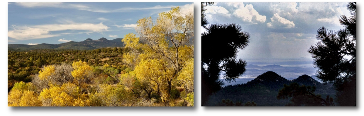
Arenas Valley sprawls across a broad alluvial plain at the base of the Piños Altos Range of the Gila National Forest, the sixth largest forest in the United States. The Piños Altos range, at least as viewed from Arenas Valley, is dominated by Signal Peak, where the U.S. Forest Service long maintained a lookout tower, and by an interesting pair of peaks called the Twin Sisters, which in my opinion should be called the Twin Boobs!
the U.S. Forest Service to blame? Throughout most of the 20th Century, intense efforts by the U.S Forest Service to extinguish forest fires left healthy parts of the forest to do their forest thing, which was to drop needles, leaves, cones, branches, and birds’ nests onto the forest floor, slowly building up the deep layers of decaying vegetation and animal matter called duff, which itself becomes home to innumerable invertebrate critters such earthworms, spiders, insects, all of whom of course die and add their bodies to the mix. The thick, mattress-like layer of duff is good when it comes to is nature’s sponge, soaking up rain and preventing runoff. In conditions of drought, the duff becomes powder dry and in effect becomes a incendiary bomb ready for ignition by a bolt of lighting, a random spark generated by human activity. That ignition can start with a barely noticeable smouldering. Under especially hot, dry conditions, however, a bolt of lightning or even a single spark can instantly turn bone-dry duff into an incendiary that can may quickly “blow-up” in new “megafires” that will be the lead story on the evening news.
It seems that Whiskey Creek (and Rio de Arenas) are bellwether warning us humans that we tamper with nature at our peril. In recent decades, megafires have burned huge swathes of the Gila National Forest, including large areas of the Piños Altos Range. We have seen how the megafires burn so hot that they destroy not only the forest above ground but sterilize the ground itself, creating ideal conditions for severe erosion and floods. Given the increasingly destructive storms that are impacting countries around the world, it’s anyone’s guess when Whiskey Creek (and Rio de Arenas) might carry floodwaters of unprecedented volume that could destroy much of Arenas Valley and the areas north and south of both of the Arenas Valley Road and Highway 180.
If Postmaster Harper had she known that Whiskey Creek’s and possibly Rio de Arenas’s history of violent floods carried warnings for the future, she might have decided to move her family to a safer location and the our address “Box 28, Arenas Valley, New Mexico” might never have existed.
[^1]